
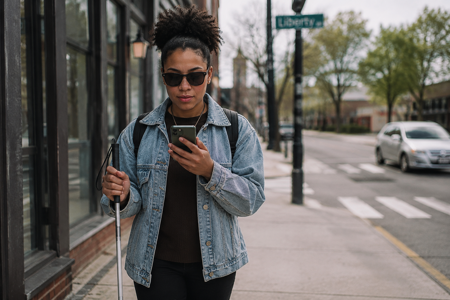

For generations, the white cane and the guide dog have been the twin pillars of independent travel for people who are blind or visually impaired. Both remain essential today, but they now have a powerful third partner: the smartphone. Modern GPS and navigation apps are converting visual information into audio guidance and haptic feedback, turning unfamiliar streets, transit systems, and even indoor spaces into journeys that blind travelers can navigate with confidence.
Here’s a look at how this technology works, which apps are leading the way, and why the smartphone in your pocket may be the most important mobility tool since the long cane itself.
Why Standard GPS Falls Short for Blind Travelers
Apps like Google Maps and Apple Maps are excellent at getting people from point A to point B, and both work with screen readers such as Apple’s VoiceOver and Android’s TalkBack. But they were designed for drivers and sighted pedestrians. They will tell you to turn left, but not which side of the street to walk on. They announce “you have arrived” when you’re within a general radius of the destination, which could put a blind traveler in the middle of the street rather than at the front door.
That gap is exactly what “blindness-aware” navigation apps, as the American Foundation for the Blind calls them, were built to fill. Rather than simply issuing turn-by-turn commands, these apps describe the environment: the names of streets and intersections as you approach them, nearby businesses and transit stops, and audio cues that help you build a mental map of your surroundings.
The Apps Leading the Way
Lazarillo is a free accessible GPS app, available on both iOS and Android, designed specifically for blind and low-vision users and praised by the Perkins School for the Blind for its intuitive layout. As you move, it announces the street you’re walking on, upcoming intersections, businesses, and transit stops, and it offers turn-by-turn audio routing to saved or searched destinations. Its exploration mode can be customized so the app announces only the categories of places you care about.
BlindSquare has long been one of the most widely used accessible GPS apps in the world. Rather than providing its own turn-by-turn directions, it works alongside Apple Maps or Google Maps, layering rich points-of-interest and intersection details on top. It draws from crowd-sourced databases to describe what’s around you as you travel, indoors and out.
Soundscape and its successors pioneered the use of 3D spatial audio, placing sound “beacons” in your environment so a destination literally sounds like it’s ahead of you or off to your left. Although Microsoft retired the original app, community-driven versions have carried the technology forward, and its spatial-audio approach continues to influence the field.
Aira takes a different approach entirely: it connects users with live, professionally trained agents who see the user’s surroundings through the phone camera and provide real-time guidance, whether that’s navigating an airport terminal or finding a specific storefront.
Solving the Indoor Problem
GPS signals weaken dramatically indoors, which historically made airports, malls, hospitals, and office buildings some of the hardest environments for blind travelers. New technology is closing that gap. GoodMaps uses LiDAR scanning to create accessible maps of large public buildings, while Clew uses the phone’s camera and motion sensors, no GPS required, to record and retrace indoor routes, guiding users back along a saved path with audio cues. The National Library Service for the Blind at the Library of Congress maintains a regularly updated reference guide to these and other wayfinding apps.
Technology Supplements Skills, It Doesn’t Replace Them
Orientation and mobility specialists are quick to point out that no app replaces foundational travel skills. GPS data can be wrong, batteries die, and signals drop. Apps also can’t detect the curb, the low-hanging branch, or the parked car blocking the sidewalk; that’s still the job of the cane, the guide dog, and the traveler’s own trained judgment. The most successful blind travelers treat these apps as a powerful supplement: the app names the intersection, and the traveler verifies it with environmental cues.
When Vision Loss Happens Suddenly
For many people, these tools aren’t adopted gradually; they become necessary overnight. Traumatic accidents, medical negligence, workplace injuries, and defective products cause thousands of cases of sudden, permanent vision loss every year. Adapting to total blindness as an adult means learning new mobility skills, acquiring assistive technology, and often rebuilding a career, all of which carry significant lifelong costs. When that vision loss was caused by someone else’s negligence, consulting an experienced attorney for total blindness in Ca can help injured individuals recover compensation for medical care, adaptive equipment, training, and lost earning capacity, resources that make independence achievable again.
The Road Ahead
The next wave of navigation technology is already arriving. Smart canes with built-in obstacle detection, AI-powered glasses that describe surroundings in real time, and increasingly precise indoor positioning are converging with GPS apps to create a full mobility ecosystem. The destination is clear: a world where a person who is blind can travel anywhere, anytime, with the same spontaneity as everyone else. Thanks to the technology already in millions of pockets, that world is closer than ever.